Start Building with Precision.

Capture every inch, every angle, and every elevation—faster. Our drone mapping services deliver the data you need to plan, verify, and build with confidence.

See the Land Clearly. Build with Certainty.

At Accurate Mapping Technologies, we specialize in drone mapping services that empower construction, engineering, and development teams to plan and build smarter.

Orthomosaic Mapping

Accurate, georeferenced site data for better planning and smarter builds.

3D Site Modeling

Fully scaled 3D models to visualize builds and integrate with CAD/BIM tools.

Topographic Surveys

Precise terrain data for grading, drainage, and design alignment.

As-Built & Site Verification

Compare real-world conditions to design plans — eliminate surprises.

Volume & Earthwork Reports

Eliminate guesswork and control costs with precision grading insights.

Construction Progress Media

Aerial Photos, Cinematic Videos, and Timelapse delivered in stunning 4K.

Why Contractors & Builders Trust Us

Save Time

Fast turnaround. No delays.

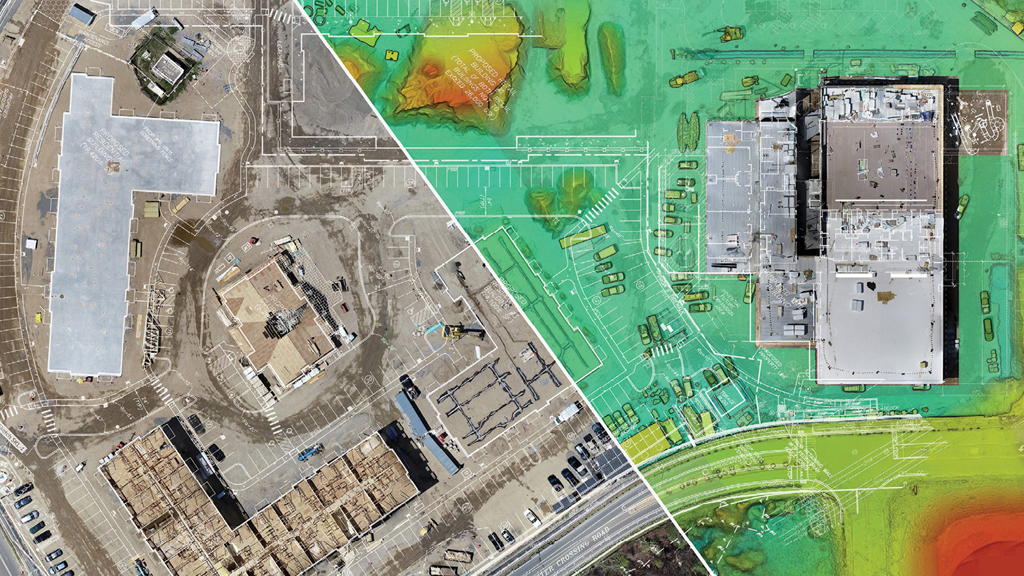
Traditional surveys take weeks. We deliver high-resolution mapping and models within days—accelerating site planning and decision-making.
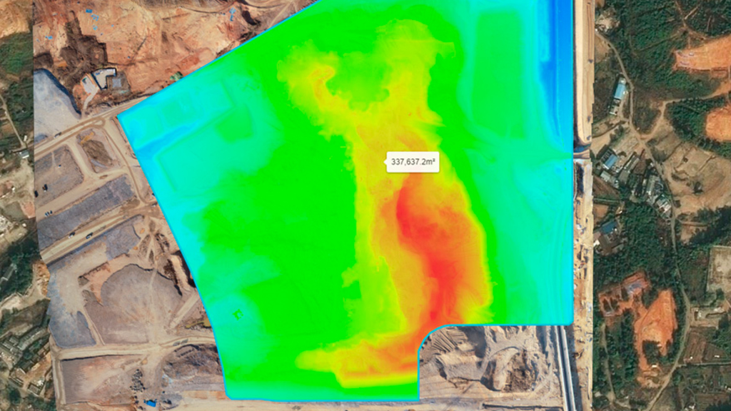
Control Costs

Prevent rework. Reduce waste.

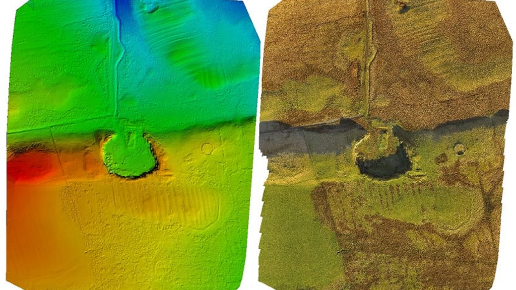
Eliminate guesswork with precise cut/fill and volume data. Reduce rework, over-excavation, and unexpected change orders.
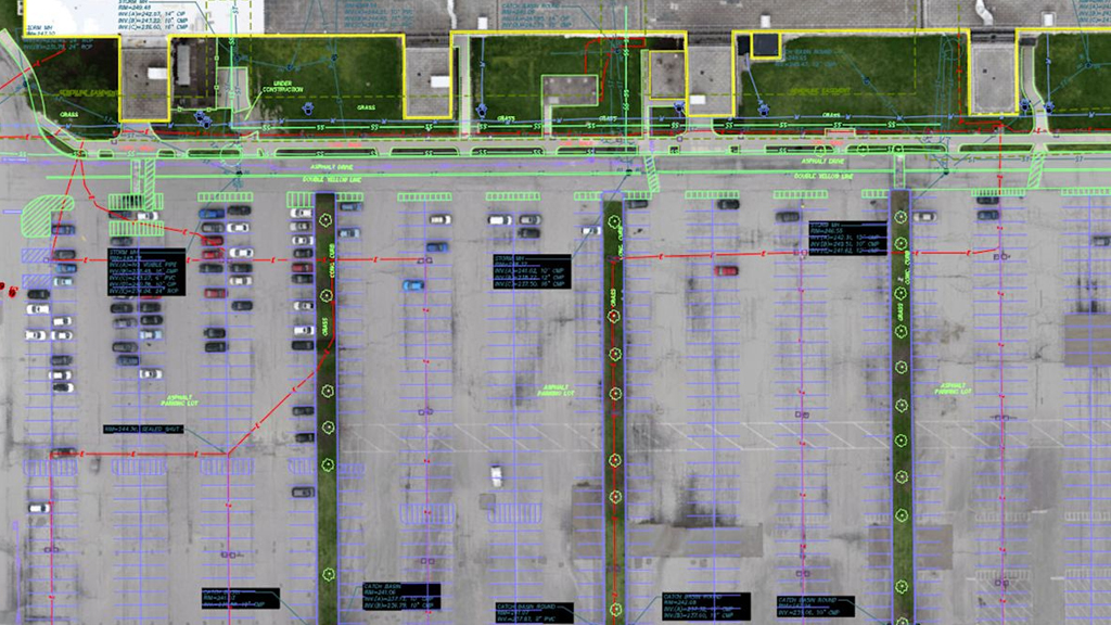
Simplify Planning

CAD-ready. Easy integration.

Our deliverables are GIS and CAD-ready, giving your team the data they need to move forward with clarity and confidence.