Our Drone Mapping & Survey Services
Unlock precision, speed, and confidence across every phase of your project. From preconstruction planning to final documentation, our aerial data solutions are built to support builders, engineers, and land developers with scalable, survey-grade deliverables.
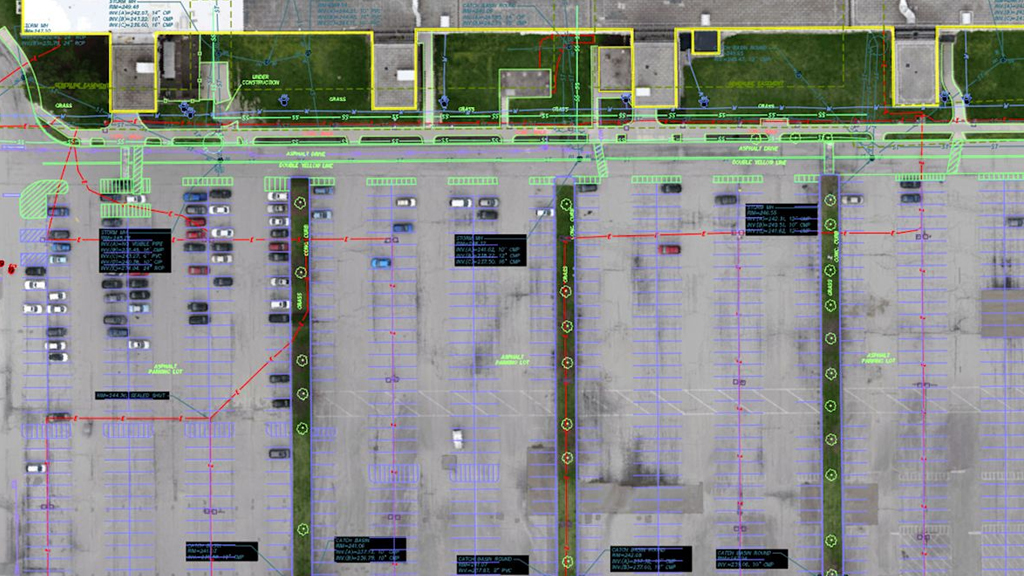
Orthomosaic Mapping
Generate geo-referenced aerial maps stitched from hundreds of high-resolution drone images. Perfect for site overviews, inspections, and design overlays.
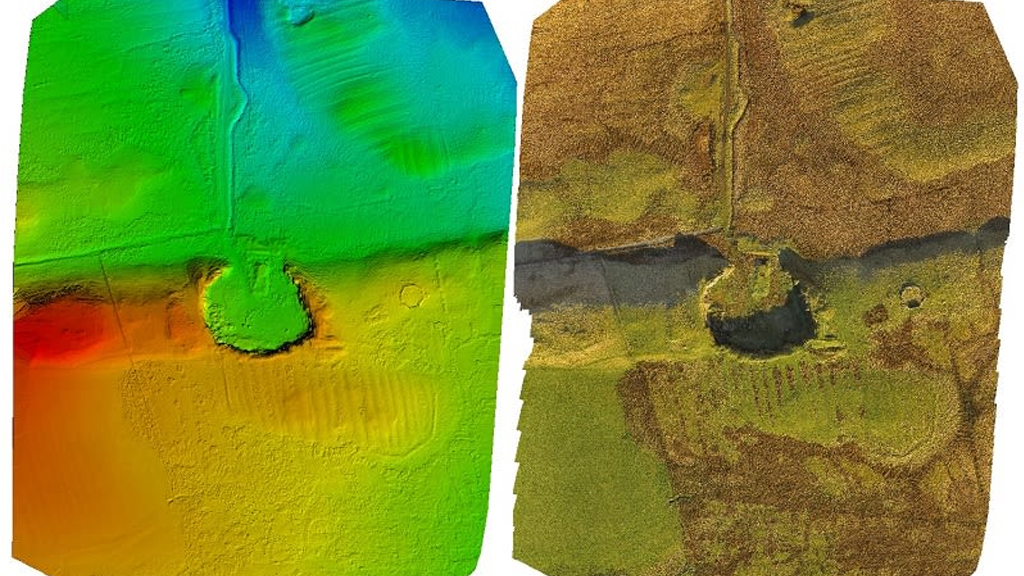
Topographic Surveys with Contour Lines
Capture accurate elevation data and generate contour lines (as tight as 1-foot intervals) to support grading plans, drainage design, and earthworks.
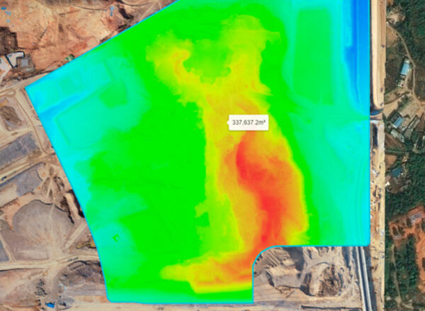
Cut & Fill Volume Calculations
Measure excavation and fill requirements with centimeter-level accuracy. Our drone-based reports help reduce cost overruns and improve site planning.
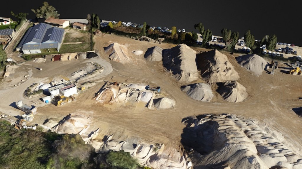
3D Drone Mapping & Site Visualization
Turn aerial imagery into scaled 3D mesh models for presentations, design integration, and construction validation. Compatible with CAD and BIM tools.
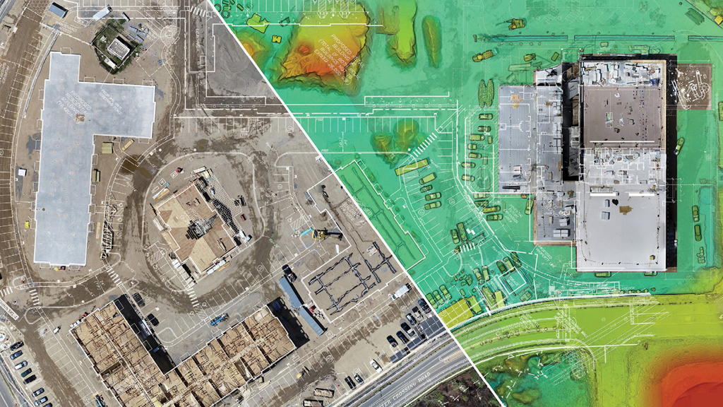
As-Built Documentation & Site Verification
Compare current site conditions to original design plans using drone imagery and mapping data. Detect deviations early and reduce costly rework.
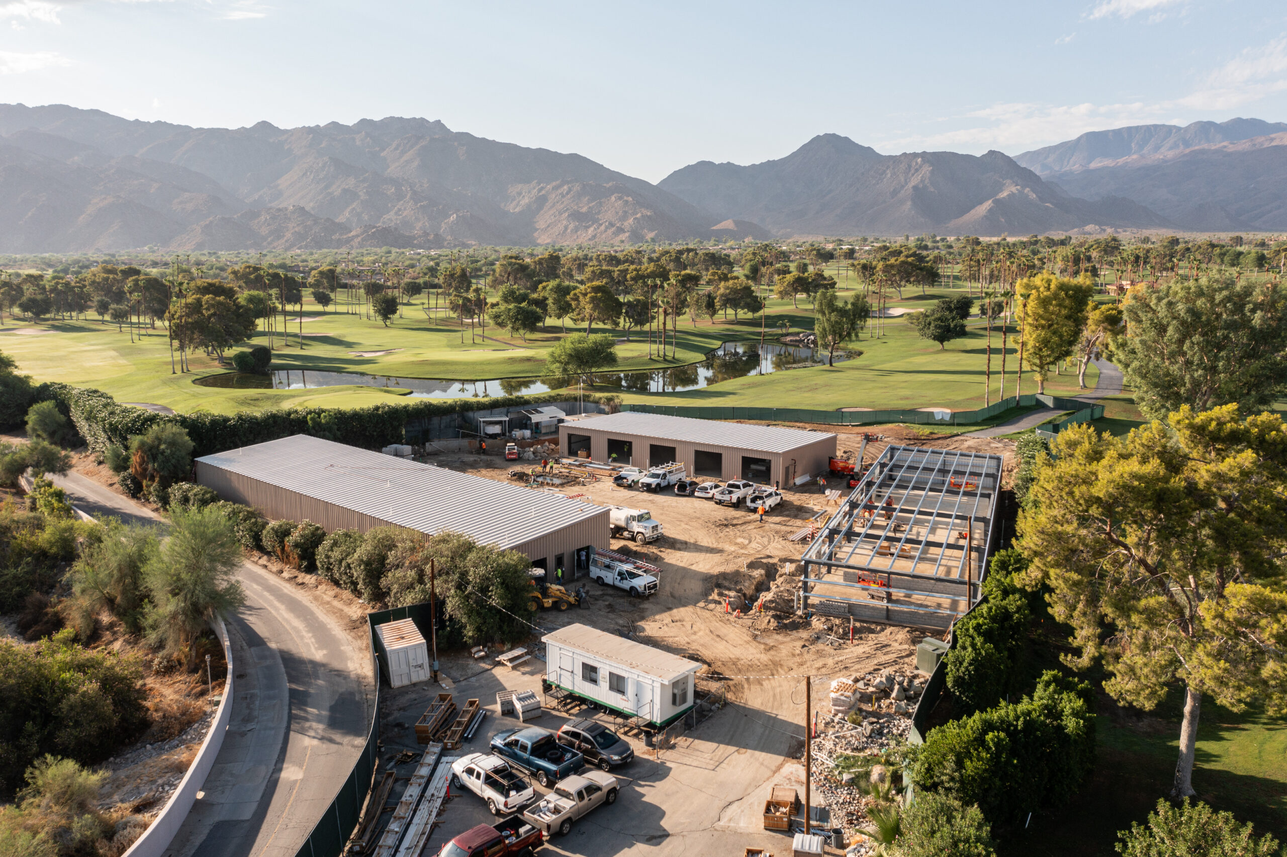
Construction Progress Documentation
Showcase and archive your build progress with 4K drone video, high-resolution photos, and annotated maps for internal reports and stakeholder updates.
Ready to Elevate Your Next Project?
From earthwork estimates to as-built verification, we help you build smarter with data that’s fast, accurate, and easy to integrate.